Brabant wallon : Différence entre versions
De GeneaFrancoBelge
| Ligne 1 : | Ligne 1 : | ||
{| align="right" rules="all" border="0" cellpadding="4" cellspacing="0" style="margin: 0 0 1em 1em; border: 1px solid #1C4D1F; border-right-width: 2px; border-bottom-width: 2px; background-color=#C4D7ED" | {| align="right" rules="all" border="0" cellpadding="4" cellspacing="0" style="margin: 0 0 1em 1em; border: 1px solid #1C4D1F; border-right-width: 2px; border-bottom-width: 2px; background-color=#C4D7ED" | ||
| − | ! colspan="2" bgcolor=#C4D7ED" | <b><font size="4" color="white"> | + | ! colspan="2" bgcolor=#C4D7ED" | <b><font size="4" color="white"> Titre </font></b> |
|----- | |----- | ||
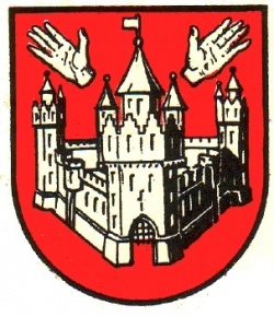
| colspan="2" align="center" | [[File:Blason-Anvers.jpg|250px|]]<br/> | | colspan="2" align="center" | [[File:Blason-Anvers.jpg|250px|]]<br/> | ||
| Ligne 8 : | Ligne 8 : | ||
| Pays || [[Image:Drapeau-Belgium.png|30px]] [[Belgique]] | | Pays || [[Image:Drapeau-Belgium.png|30px]] [[Belgique]] | ||
|----- | |----- | ||
| − | | Région|| [[ | + | | Région|| [[xxxx]] |
|----- | |----- | ||
| Population | | Population | ||
| Ligne 15 : | Ligne 15 : | ||
| Superficie || 2867 km² | | Superficie || 2867 km² | ||
|----- | |----- | ||
| − | | Arrondissements || [[ | + | | Arrondissements || [[xxx]] |
|----- | |----- | ||
| − | | Communes || | + | | Communes || xx communes |
|----- | |----- | ||
! colspan="2" bgcolor=#C4D7ED" | <b><font color="white"> Liens complémentaires </font></b> | ! colspan="2" bgcolor=#C4D7ED" | <b><font color="white"> Liens complémentaires </font></b> | ||
| Ligne 25 : | Ligne 25 : | ||
! colspan="2" bgcolor=#C4D7ED" | <b><font color="white"> Localisation </font></b> | ! colspan="2" bgcolor=#C4D7ED" | <b><font color="white"> Localisation </font></b> | ||
|----- | |----- | ||
| − | | colspan="2" align="center" | [[ | + | | colspan="2" align="center" | [[xxxx|right|350px|]] |
|} | |} | ||
Version du 24 février 2019 à 20:10
| Titre | |
|---|---|
 | |
| Informations | |
| Pays | |
| Région | xxxx |
| Population | xxxx hab. 2010 |
| Superficie | 2867 km² |
| Arrondissements | xxx |
| Communes | xx communes |
| Liens complémentaires | |
| Localisation | |
| right|350px| | |
Sommaire
Histoire
Liste des communes
Les 27 communes du Brabant Wallon (113 sections) en 1 arrondissement :
Arrondissement de Nivelles
27 communes - 113 sections
- Beauvechain (Bevekom)
- Braine-l'Alleud (Eigenbrakel)
- Braine-le-Château (Kasteelbrakel)
- Chastre
- Chaumont-Gistoux
- Court-Saint-Etienne
- Genappe (Genepiën)
- Grez-Doiceau (Graven)
- Hélécine
- Incourt
- Ittre
- Jodoigne (Geldenaken)
- La Hulpe (Terhulpen)
- Lasne
- Mont-Saint-Guibert
- Nivelles (Nijvel)
- Orp-Jauche
- Ottignies-Louvain-la-Neuve
- Perwez (Perwijs)
- Ramillies
- Rebecq
- Rixensart
- Tubize (Tubeke)
- Villers-la-Ville
- Walhain
- Waterloo
- Wavre (Waver)
Liste des communes dépouillées
Liste des liens
- Netradyle
- GEPHIL-ESM
- Cercle Historique, Archéologique et Généalogique de Wavre et du Brabant Wallon
- C.R.H.G. Hélécine
- Cercle d'histoire, d'archéologie et de généalogie d'Ottignies/Louvain-la-Neuve
| |||
|
Anvers • Brabant flamand • Brabant wallon • Bruxelles-Capitale • Flandre occidentale • Flandre orientale • Hainaut • Liège • Limbourg • Luxembourg Belge • Namur |