Anvers : Différence entre versions
De GeneaFrancoBelge
| (47 révisions intermédiaires par 2 utilisateurs non affichées) | |||
| Ligne 1 : | Ligne 1 : | ||
| + | {| align="right" rules="all" border="0" cellpadding="4" cellspacing="0" style="margin: 0 0 1em 1em; border: 1px solid #1C4D1F; border-right-width: 2px; border-bottom-width: 2px; background-color=#C4D7ED" | ||
| + | ! colspan="2" bgcolor=#C4D7ED" | <b><font size="4" color="white"> [[Anvers]] </font></b> | ||
| + | |----- | ||
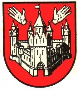
| + | | colspan="2" align="center" | [[File:Blason-Anvers.jpg|250px|]]<br/> | ||
| + | |---- | ||
| + | ! colspan="2" bgcolor=#C4D7ED" | <b><font color="white">Informations</font></b> | ||
| + | |----- | ||
| + | | Pays || [[Image:Drapeau-Belgium.png|30px]] [[Belgique]] | ||
| + | |----- | ||
| + | | Région|| [[Flamande]] | ||
| + | |----- | ||
| + | | Population | ||
| + | | 1847485 hab. <small> 2018</small> | ||
| + | |----- | ||
| + | | Superficie || 2867 km² | ||
| + | |----- | ||
| + | | Arrondissements || [[Anvers]] | ||
| + | |----- | ||
| + | | Communes || 70 communes | ||
| + | |----- | ||
| + | ! colspan="2" bgcolor=#C4D7ED" | <b><font color="white"> Liens complémentaires </font></b> | ||
| + | |----- valign="top" | ||
| + | | colspan="2" | <center> [http://www.example.com/ titre du lien] </center> | ||
| + | |----- | ||
| + | ! colspan="2" bgcolor=#C4D7ED" | <b><font color="white"> Localisation </font></b> | ||
| + | |----- | ||
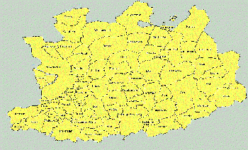
| + | | colspan="2" align="center" | [[File:province_anvers.gif|right|350px|]] | ||
| + | |} | ||
| + | |||
| + | |||
= Histoire = | = Histoire = | ||
| − | + | Elle est située au nord de la Belgique et est placée sous la tutelle de la Région flamande. C'est la plus peuplée des dix provinces du Royaume avec 1 855 486 habitants2 en 2019. Elle tient son nom de la principale ville, qui en est aussi le chef-lieu : Anvers. | |
= Liste des communes = | = Liste des communes = | ||
| Ligne 103 : | Ligne 133 : | ||
| − | {| align="center" cellspacing="0" style="margin-top: 2em; width: 85%; background-color:# | + | {| align="center" cellspacing="0" style="margin-top: 2em; width: 85%; background-color:#fffff; padding:5px; border:1px solid #000000; border-right-width: 2px; border-bottom-width: 2px; line-height: 1.5em" |
| | | | ||
| − | {| style="background:# | + | {| style="background:#452155" align="center" width="100%" |
| padding="5px" | | | padding="5px" | | ||
| style="background:#00000" align="center" width="100%" | <b><font color="white"> '''Liste des provinces belges''' </font></b> | | style="background:#00000" align="center" width="100%" | <b><font color="white"> '''Liste des provinces belges''' </font></b> | ||
| Ligne 112 : | Ligne 142 : | ||
|- colspan="3" align="center" style="font-size: 90%;" | |- colspan="3" align="center" style="font-size: 90%;" | ||
| | | | ||
| − | [[Anvers|Anvers]] • [[Brabant flamand|Brabant flamand]] • [[Brabant wallon|Brabant wallon]] • [[Bruxelles-Capitale|Bruxelles-Capitale]] • [[Flandre occidentale|Flandre occidentale]] • [[Flandre orientale|Flandre orientale]] • [[Hainaut|Hainaut]] • [[Liège|Liège]] • [[Limbourg|Limbourg]] • [[Luxembourg|Luxembourg]] • [[Namur|Namur]] | + | [[Anvers|Anvers]] • [[Brabant flamand|Brabant flamand]] • [[Brabant wallon|Brabant wallon]] • [[Bruxelles-Capitale|Bruxelles-Capitale]] • [[Flandre-occidentale|Flandre occidentale]] • [[Flandre orientale|Flandre orientale]] • [[Hainaut|Hainaut]] • [[Liège|Liège]] • [[Limbourg|Limbourg]] • [[Luxembourg Belge|Luxembourg Belge]] • [[Namur|Namur]] |
|} | |} | ||
Version actuelle datée du 13 avril 2019 à 06:44
| Anvers | |
|---|---|
 | |
| Informations | |
| Pays | |
| Région | Flamande |
| Population | 1847485 hab. 2018 |
| Superficie | 2867 km² |
| Arrondissements | Anvers |
| Communes | 70 communes |
| Liens complémentaires | |
| Localisation | |
Sommaire
Histoire
Elle est située au nord de la Belgique et est placée sous la tutelle de la Région flamande. C'est la plus peuplée des dix provinces du Royaume avec 1 855 486 habitants2 en 2019. Elle tient son nom de la principale ville, qui en est aussi le chef-lieu : Anvers.
Liste des communes
Les 70 communes de la province d'Anvers (composées de 141 sections), par arrondissement :
Arrondissement d'Anvers
30 communes - 48 sections
- Aartselaar
- Anvers (Antwerpen)
- Boechout
- Boom
- Borsbeek
- Brasschaat
- Brecht
- Edegem
- Essen
- Hemiksem
- Hove
- Kalmthout
- Kapellen
- Kontich
- Lint
- Malle
- Mortsel
- Niel
- Ranst
- Rumst
- Schelle
- Schilde
- Schoten
- Stabroek
- Wijnegem
- Wommelgem
- Wuustwezel
- Zandhoven
- Zoersel
- Zwijndrecht
Arrondissement de Malines
13 communes - 41 sections
- Berlaar
- Bonheiden
- Bornem
- Duffel
- Heist-op-den-Berg
- Lierre (Lier)
- Malines (Mechelen)
- Nijlen
- Putte
- Puurs
- Sint-Amands
- Sint-Katelijne-Waver
- Willebroek
Arrondissement de Turnhout
27 communes - 52 sections
- Arendonk
- Baarle-Hertog
- Balen
- Beerse
- Dessel
- Geel
- Grobbendonk
- Herentals
- Herenthout
- Herselt
- Hoogstraten
- Hulshout
- Kasterlee
- Laakdal
- Lille
- Meerhout
- Merksplas
- Mol
- Olen
- Oud-Turnhout
- Ravels
- Retie
- Rijkevorsel
- Turnhout
- Vorselaar
- Vosselaar
- Westerlo
Liste des communes dépouillées
Liste des liens
- Familiekunde Vlaanderen
- Cimetière d'Anvers
Cartes postales
| |||
|
Anvers • Brabant flamand • Brabant wallon • Bruxelles-Capitale • Flandre occidentale • Flandre orientale • Hainaut • Liège • Limbourg • Luxembourg Belge • Namur |


